In middle school geology classes around the world, there could soon be a new way to study the Himalaya mountain range or the Tibetan Plateau: on a 3-D printed model.
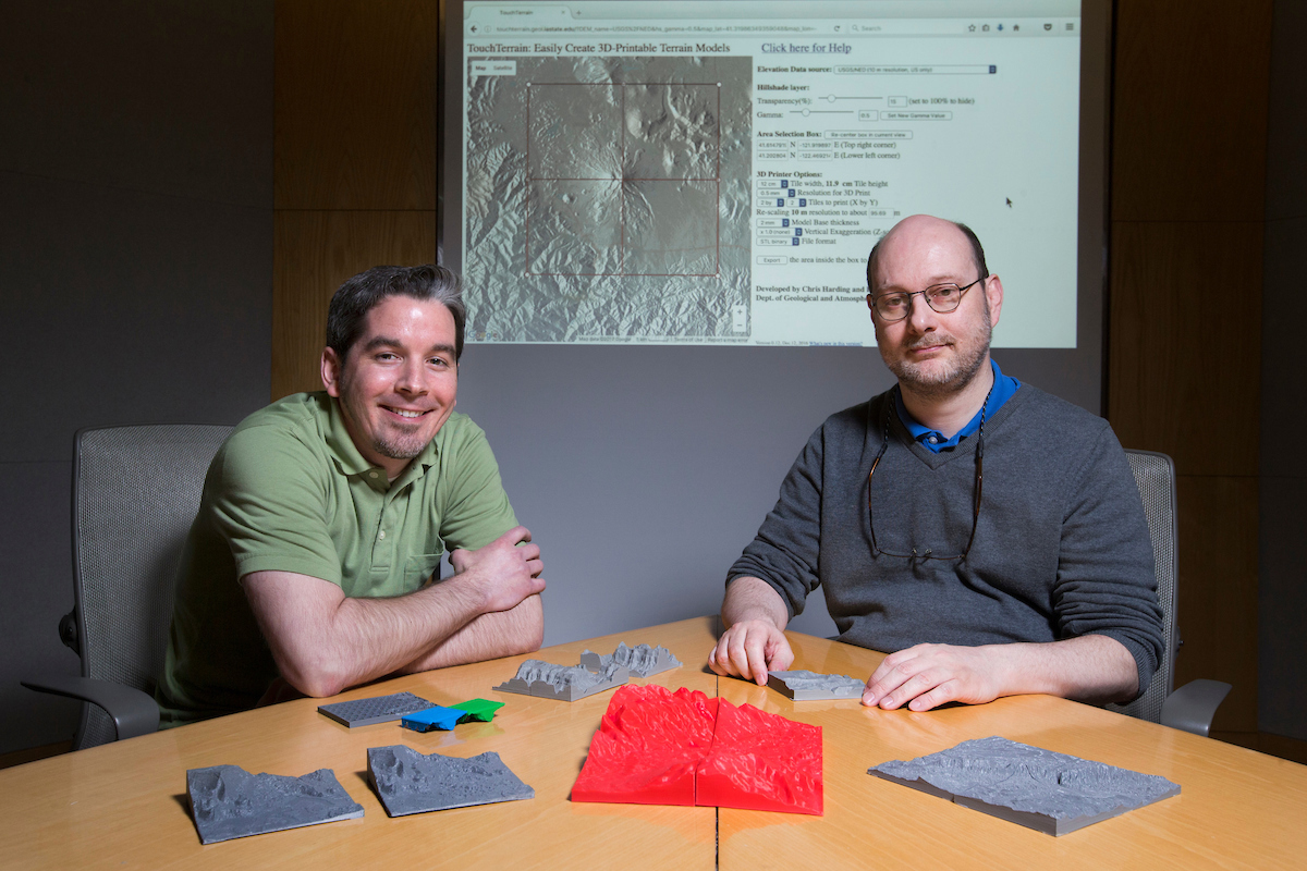
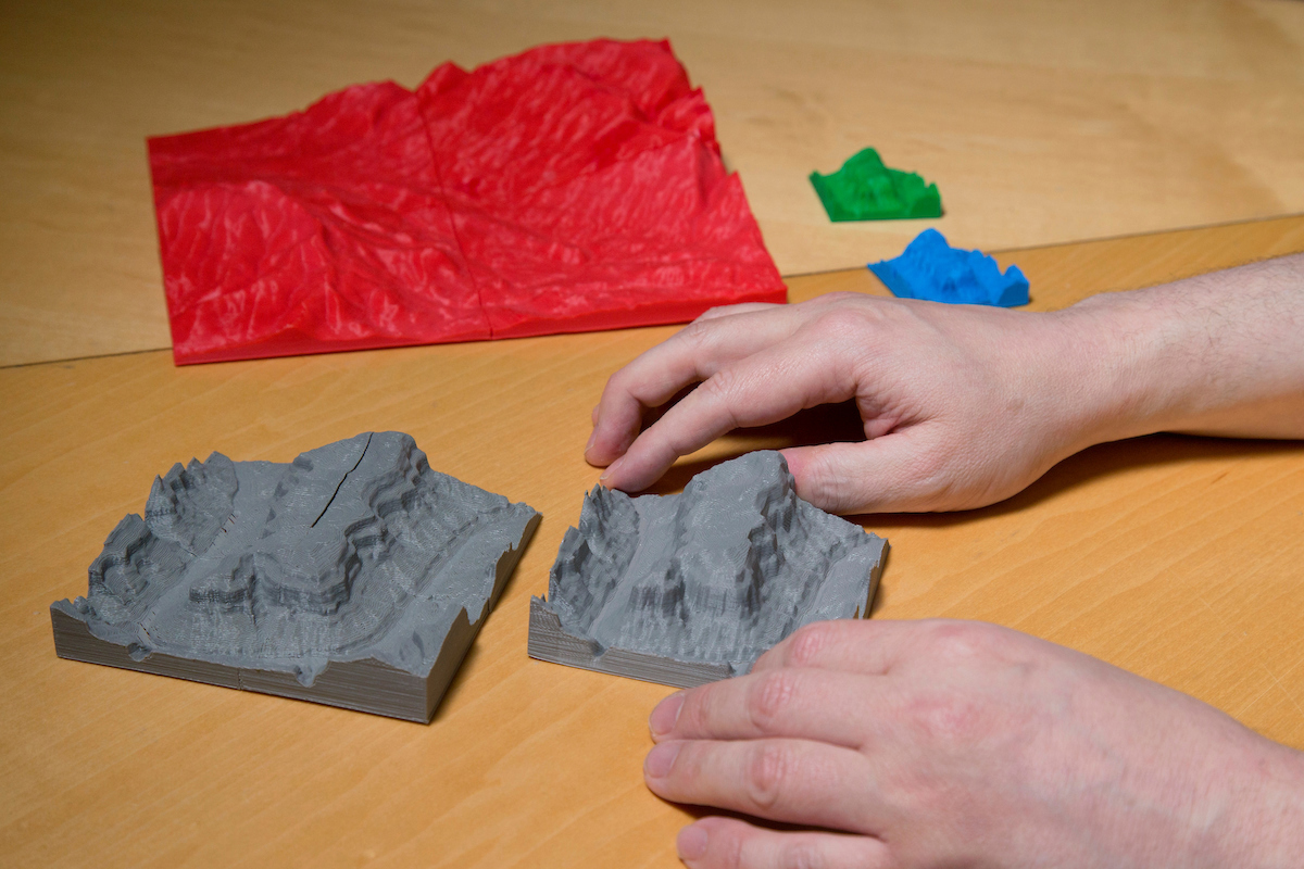
TouchTerrain, a new app built by Iowa State researchers, began as a service for geology teachers to help students learn. The web application makes printing 3-D terrain models of any place on earth, including the ocean floor, simple and inexpensive. The 3-D models help students understand how big a fault is, for example, or what different river valleys look like, and they can be used anywhere communication about the environment is needed – no field trip required.
"A major hurdle for students learning geology is thinking in 3-D and developing a sense of scale," Franek Hasiuk, assistant professor in the Department of Geological and Atmospheric Sciences, said. "If we can simplify this task for students, we hope students will learn more, faster. By being literate in 3-D printing, they will also be better at communicating their science to non-geologists."
Hasiuk, along with Chris Harding, associate professor in the Department of Geological and Atmospheric Sciences; Levi Baber, manager of information technology in LAS; and Alex Renner, a graduate student in mechanical engineering; all contributed to TouchTerrain.
The app has value beyond the classroom, too. With TouchTerrain, career geologists can visualize geographical traits such as pore spaces in rocks or Earth’s layers below the surface.
Jaimie Addy (’10 geology), a geologist and land manager at Oldcastle Materials Group Midwest in Sioux City, Iowa, expressed interest in using the models to communicate about quarry sites in the aggregate mining industry. He could use TouchTerrain for planning and modeling a mine, as well as community planning at the final reclaimed site after mining activity is over.
"By having access to a relatively inexpensive physical terrain model, we can eliminate most of the visualization challenges associated with long-term mine planning," Addy said. "I'm excited to see how this newly developed technology can fit in with our current exploration practices."
Innovation for simpler planning
Not everyone is well versed in reading blueprints or two-dimensional plans, but imagine if you could pitch a plan for a new building or roadway with a 3-D printed model of the proposed project. Suddenly, everyone can see the project clearly.
“A 3-D printed model can be especially useful in communicating with audiences that do not have a background in reading 3-D graphics – especially of terrain – on a computer screen,” Hasiuk said. “It could be used at all stages of K-12 education. It could be used by governments to evaluate planning decisions and answer questions such as, ‘What will a new subdivision look like?’ or ‘What will different highway alignments look like?’ Finally, if an audience has a visual impairment, a tangible model may be their only way to learn about a landform.”
What makes TouchTerrain special is the technology that makes it inexpensive – and simple – to use. Before the development of the app, making a 3-D terrain model involved converting data from a government website into a series of points which were mapped by hand on a computer as a terrain surface using a geographical information system. Then sides and a base would need to be added before the final 3-D rendering could be sent to a printer. This process could take days to create the model to be printed, even for someone trained in the technology.
With the use of TouchTerrain, a model for any 3-D printer can be made in a matter of minutes with little more than a point and a click. Users simply drag a box over a map to highlight an area and the app pulls the terrain data needed for that area from Google Earth Engine. Settings can be applied to emphasize subtle details or adjust the resolution capabilities of the user’s printer to ensure that the file size is appropriate for the printer being used.
The (low) cost of innovation
The technology is extraordinary, but the cost is not. The web application is open source and free for private use through Iowa State’s GeoFabLab. It allows anybody with a 3-D printer (now available for less than $2,000) to easily and quickly print terrain models of any place on the planet, including the ocean floor.
Typical printed models are four square inches or four-by-six inches, similar in size to a smartphone map viewer, and typically cost about $2. TouchTerrain also allows for larger areas to be printed in multiple blocks of the size specified, making it easy to make a larger model with any printer.
The ISU researchers’ next steps include enhancing the application’s capabilities and creating a way for teachers to connect specific locations with specific geologic concepts.